
GIS for CAD
Bring your GIS data in DWG with style
Bring your GIS data in DWG
with style
Prepare GIS for CAD maps once
and use many times
GIS for CAD web service
GIS for CAD solution consists of GeoSX server and desktop CAD add-on. GeoSX is configured to connect to your existing GIS databases. GeoSX is used to serve maps and data to desktop add-on or to web clients. GeoSX server can run on-premises or in the cloud.
Select what you want
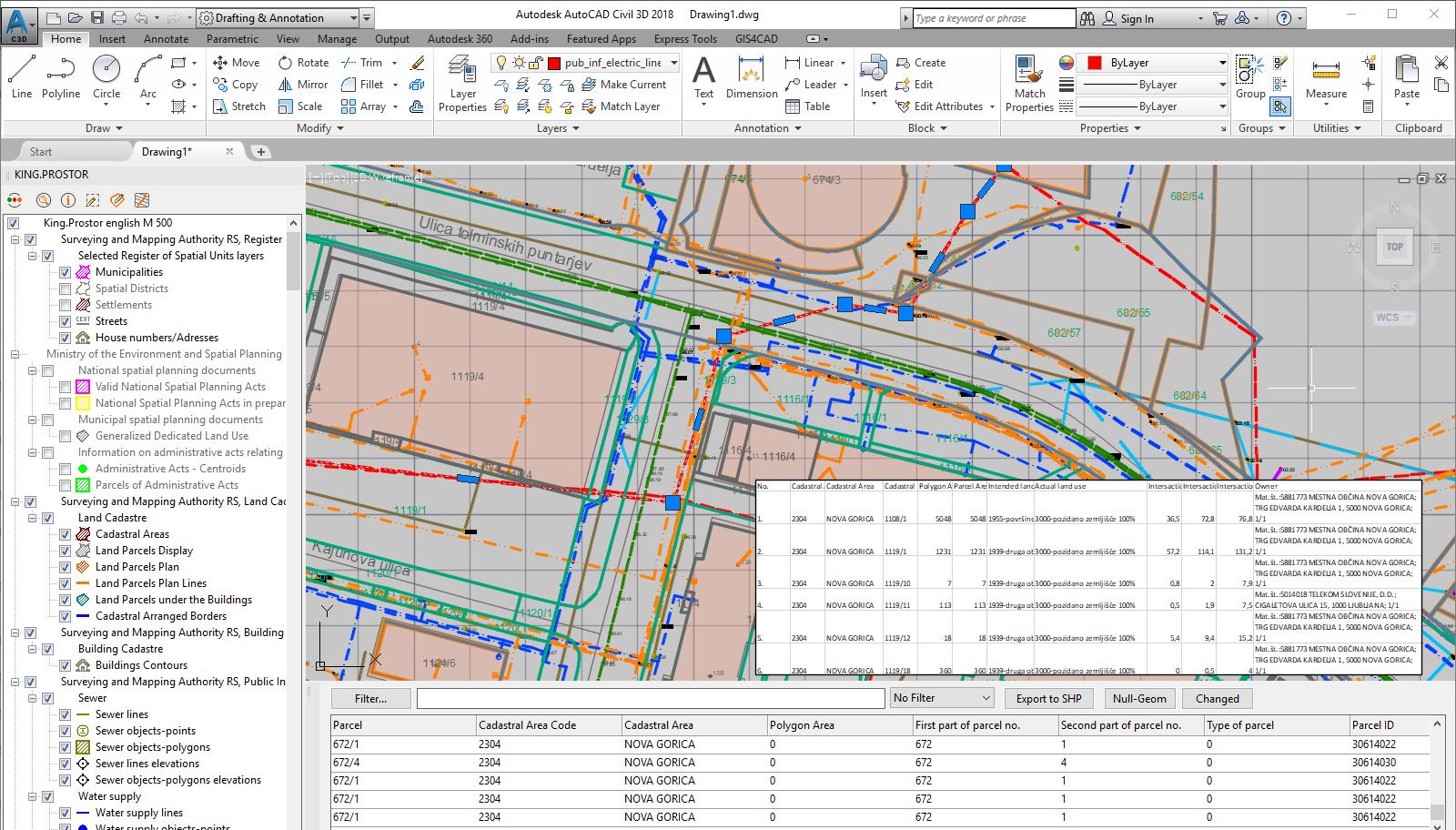
From large GIS datasets, you can select only the data you want. Using your standard CAD software, locate area of interest and bring the GIS data in dwg with a single click. Get the graphics and explore the data attributes as well.
DWG as user wants it
GIS features are displayed as standard dwg entities: points, lines, polylines, blocks, texts, and hatches.
Each dwg style and property can be configured and preset in G4C Map.
Work with GIS data the same way as you have always worked in your CAD.

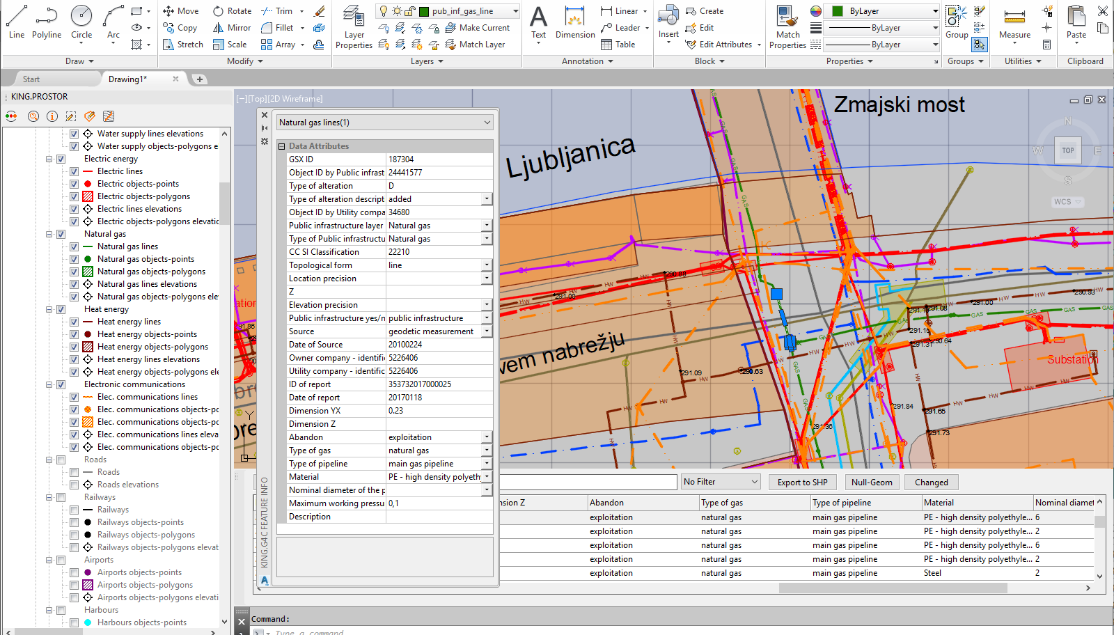
Data attributes
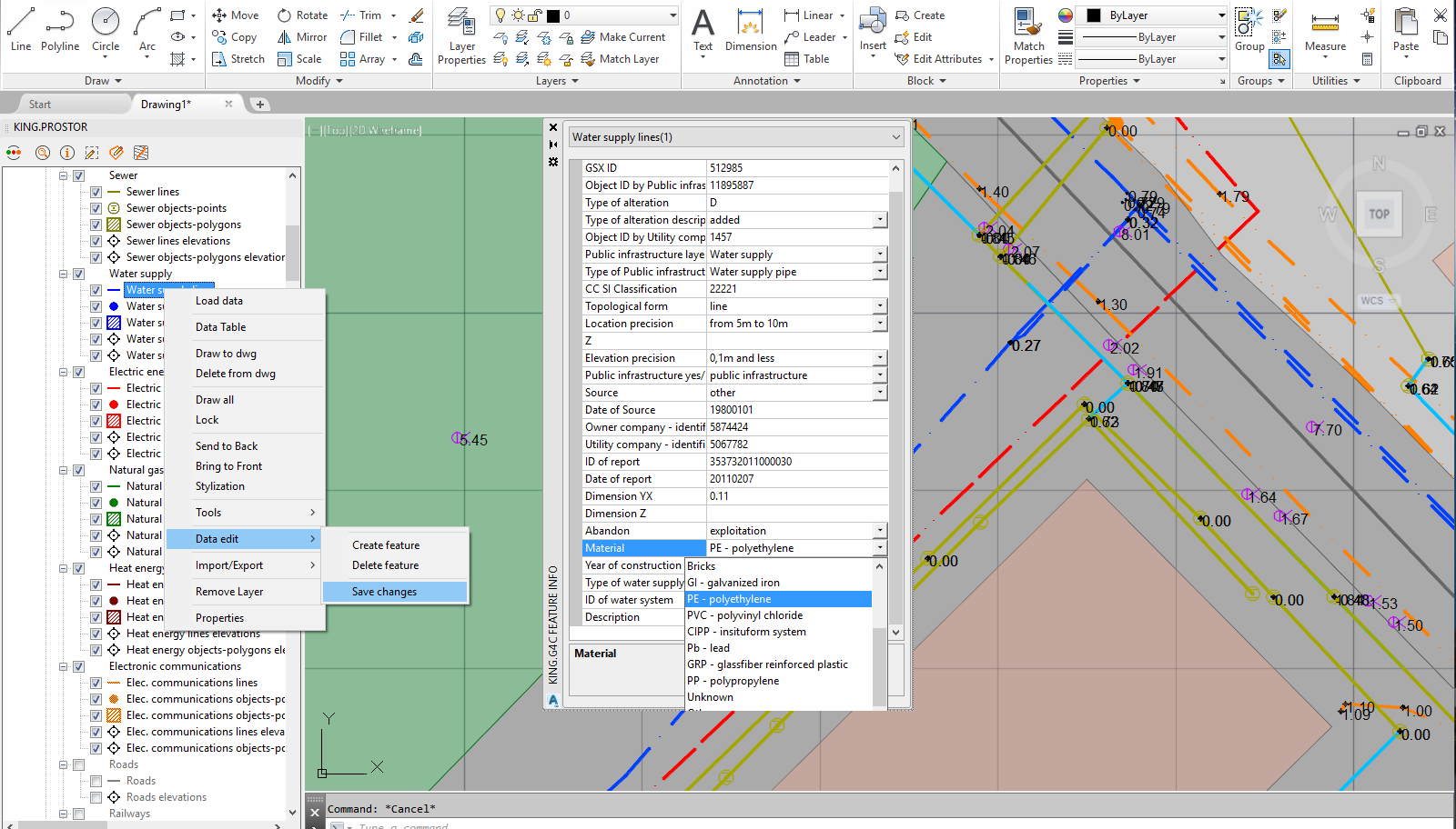
Explore, search and filter data attributes inside GIS for CAD. Display attributes in info window for selected dwg entities. Explore the data using report tables and powerful filter functions. Select features in table and auto select and zoom in dwg or vice versa.
G4C Map per use case
Create multiple G4C Maps for different user groups e.g. planning, management, maintenance.
Each map can have different layers, styles, scales, dwg templates...
Multiple G4C Maps for different user and workflows.
Data editing
GIS layers can be configured for data editing. Prepare edit window with configurable attribute edit fields. Geometry is modified using standard CAD commands e.g. simple vertex move. Changes are done in off-line mode and committed on request.
Use cases
VO-KA Ljubljana is responsible for water supply and waste water drainage and treatment system for city Ljubljana. VO-KA Ljubljana implemented GIS for CAD to enable different departments to access their internal GIS data.
GIS data is maintaned in ArcGIS Server.
Read more...
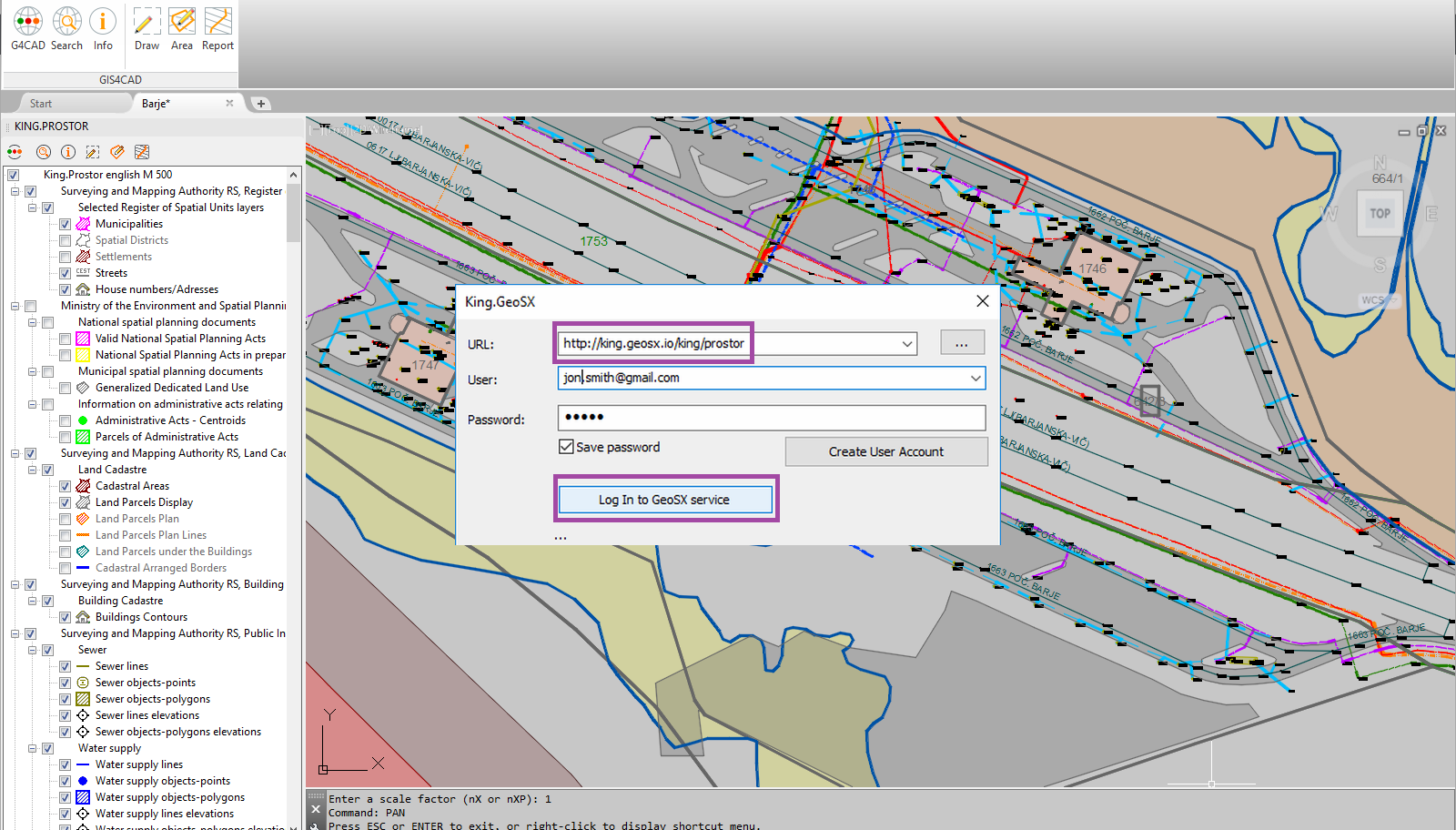
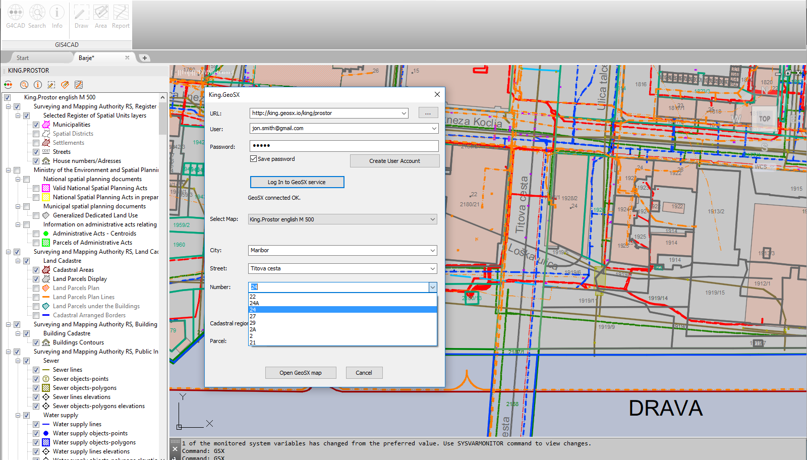
King.Prostor is a service, offering publicly available GIS data to engineers, surveyors, architects. King.Prostor includes set of over 350 data layers: parcels, water, power distribution, public infrastructure, environmental and others. All this data is avalible to GIS for CAD users on one click.
Read more...
DEEO NT is GIS solution for Smart Grid. DEEO NT implements technical database with spatial and network topology, power trace, on the fly schematics, in-station schematics.
Read more...