Use Cases
- Connect CAD users to existing GIS databases Enterprise internal GIS databases
- Cloud service to distribute GIS data King.Prostor
- Technical database with spatial and network topology DEEO NT
JP Vodovod-Kanalizacija
Internal GIS databases
JP Vodovod-Kanalizacija is responsible for water supply and waste water drainage and treatment system for Slovenian capital city Ljubljana.
VO-KA manages over 1100 km of water distribution and 1139 km of waste water network. VO-KA has implemented ESRI ArcGIS server and uses ArcGIS desktop to maintain data. GIS data is kept in Oracle database.
Departments using .dwg
VO-KA departments for planning and surveying needs to daily access the data from their AutoCAD's. Also they need to provide latest data of working areas to outside companies in form of .dwg.
Often they would send shp files between departments or would use desktop GIS tool to create dwg exports. In any case it was tedious process. Even after getting data in dwg they would need to put lot of time and effort to make dwg look as they want to.
Use of GIS for CAD VO-KA installed internal GeoSX server. GeoSX is configured to connect to existing data in Oracle. Different G4C maps are created for planing, surveying and for outside use of the data.
Publicly available GIS data from Slovenia
Slovenian ministries and government agencies has gather lot of GIS data and made it freely available. Available data are: land cadastre, building cadastre, orthophoto, public infrastructure
, topographic maps, cultural heritage, noise, water protected areas, Natura 2000 and many others. Lot of effort is made to collect and maintain the data. There are over 350 data layers.
SHP, WMS, WFS, Web map viewer, GIS portals
The data is offered in different file formats, web services or web viewers. With web viewers data can be viewed but it can't be imported into CAD software to use it there.
Importing different file formats and web services to CAD can be complicated and frustrating. There are lot of CAD users who would want to use the data in everyday tasks but they hit the wall of GIS/CAD integration. GIS for CAD cloud service
King.Prostor is web service which allows users to access freely available Slovenian GIS data.
The data is configured on King.Prostor cloud servers and GIS for CAD maps are prepared. With King.Prostor CAD users can connect to G4C map, select area of interest
and with single click bring the data in dwg with style. GIS data will be display as standard dwg entities. Raster images can be inserted as well.
Interactive data
Beside geometry, GIS for CAD will allow display of data attributes as well. Data can be searched and filtered in data tables.
Try King.Prostor
King.Prostor service is free to use for 30 days. You just need email to create free account. Watch video about King.Prostor service (Slovenian language) video. Try King.Prostor at http://kingprostor.si/tryit.html
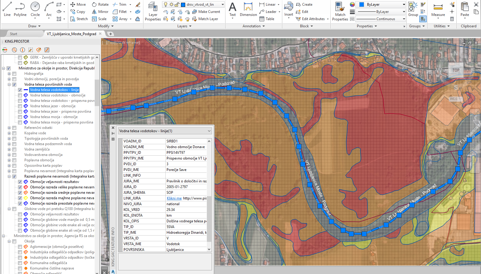
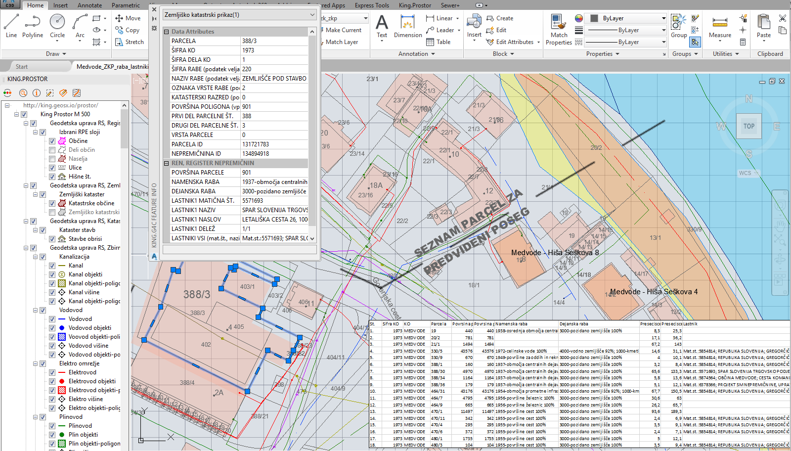
River body Ljubljanica Moste - Podgrad with river flooding stages from Water cadastre, Slovenian Water Agency. City Medvode, building cadastre, land cadastre, real estate register, public infrastructure, cultural heritage, running waters and flooding. Technical database with spatial and network topology
JP EP BiH is responsible for electricity distribution to over 750.000 customers and has around 37.000 km of distribution lines.
EP BiH used to have different CAD/GIS systems and separate technical database. Some parts of network were digitized but there was no central database, lot of data was still on paper or mainly in dwg's.
They wanted to implement central technical database with spatial and network topology. They choose our GeoSX based solution named DEEO NT.
Hundreds of users edits distribution network, with confidence
In JP EP BiH there was already many users experienced in using CAD and there was lot of data in dwg. Using DEEO NT there were able to immediately start editing their network.
While editing network DEEO NT transparently checks network for spatial topology and connectivity. User immediately gets feedback (e.g. gray line for none and red color for connected lines) for their edits.
In around one year, there were able to create reliable technical database with spatial and network topology with connectivity outside and inside power stations.
Power trace, Network Schematics, In-station schematics
DEEO NT allows users to trace power, e.g. to get which meters will be disconnected in case of disruption. For each point in network they can check trough which network lines is connected to higher stations.
For any part of network, schematics can be created on the fly, and it takes current state of switches and other network elements. In-station schematics are also created on request with latest data.
SAP, MDM, CRM, Web GIS portal
DEEO NT web services are used by other IT systems to read technical data from network. Web portal allows searching, viewing, reporting and editing of selected data.
For questions and support you can reach us at +386 1 565 75 65 or via email info@gisforcad.com.
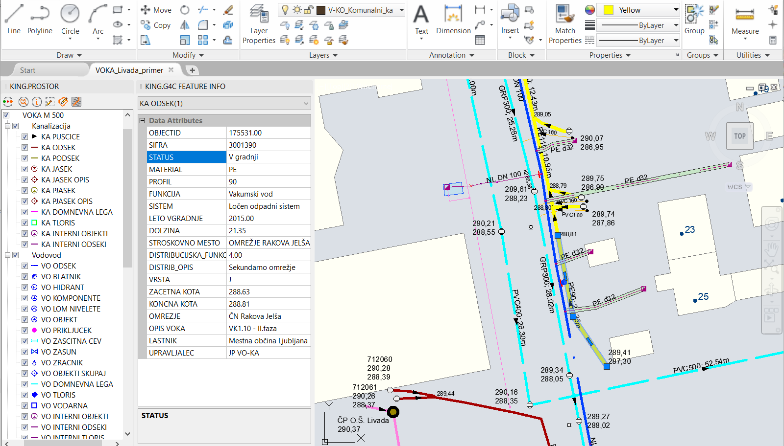
Now, with GIS for CAD they can easily access the data from CAD. Data in .dwg is displayed exactly as they want to. Tasks which previously took hours to complete are now done with single click.
VO-KA sample dwg displaying water supply and drainageKing.Prostor
With GIS for CAD we can get which land parcels and area of intersection with our design. Also we can select dwg entities representing e.g. road centerlines and get all crossings with public infrastructure.
Sample maps from King.ProstorJP EP BiH - Public Electric Utility
Contact